Hurricane!

Track your favorite Hurricane on your TI calculator. Key in the Coordinates for your coast line, using the X list for Longititude (with West being Negative) and the Y list being Lattitude (with South being negative). Then in another list place the day by day (or hour by hour) coordinates of the current Hurricane. In the example (HURC.83p or HURC.73p) see the possibilities. In the sample, B stands for Brownsville, Texas and CC stands for Corpus Christi, Texas. To see the USA pick the 73 program, or the 83 version.


Some Hurricane links:

Hurricane Watch '98
Hurricane & Storm Tracking Atlantic & Pacific Oceans
Hurricane Hunters Home Page
NATIONAL HURRICANE CENTER TROPICAL PREDICTION CENTER
American Meteorological Society Homepage 1998
The Weather Channel - Tropical Update Index
The Weather Channel - Education: Sites For Weather Education
1997 ATLANTIC HURRICANE SEASON
1996 ATLANTIC HURRICANE SEASON
1995 ATLANTIC HURRICANE SEASON

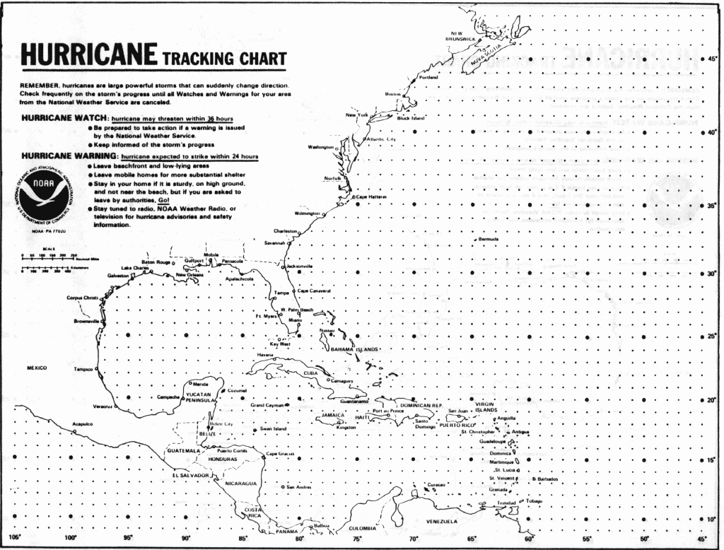
Download the Hurricane Tracking Chart

track_chart.gif (123417 bytes)

or thy TerraServer by Microsoftİ

TEKS Toolkit - Mathematics and Science

The Dana Center